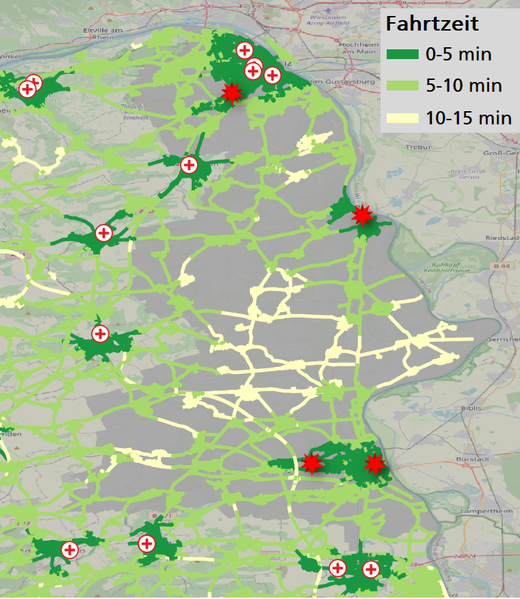
Every second counts in emergency rescue. The faster the emergency services arrive at the scene, the better the patient's chances of a successful recovery. In particular, the travel time to the scene of the emergency is a decisive factor. The choice of location for rescue stations is therefore essential for good rescue service provision. The question arises: Where are the optimal locations for rescue stations?
Optimization of Rescue Station Locations
Project Location and Demand Analysis
Optimizing Historically Grown Site Structures
Gradually, rescue stations with old building structures have to be renovated or newly built. However, before high construction costs are invested, an evaluation of the site structure is highly recommended. A (now) unfavorably located site should not be held on to in the future. In other cases, construction at the same location is no longer possible. As a result, relocation of rescue stations may be sensible and necessary, especially if several rescue stations in close proximity to each other are under discussion.
With the help of data-supported, mathematical methods, we analyze the site structure and calculate optimal combinations of possible locations for emergency stations – always in interaction with surrounding existing stations. The goal is always to improve the provision of emergency services to the population with limited resources.
Supporting Decisions with Mathematical Modeling and Simulation
When optimizing the location structure, the first step is to perform an accessibility analysis based on the rescue stations. For this purpose, a speed profile is estimated specifically for rescue vehicles with special signals on the basis of historical deployment data. With complete travel time information from each possible rescue station location to each possible deployment location, »optimal« location combinations can be calculated. »Optimal« means that as many inhabitants as possible can be reached in as short a time as possible from a rescue station. The statutory maximum travel time of 15 minutes must, of course, be adhered to everywhere.
In a second step, we subject the most promising location combinations to a »practical test«. This involves a detailed simulation of the operations of recent years – with a modified location structure. In this way, we take into account the highly dynamic nature of the rescue service with its time-based availability and on-the-road alerting. Based on the results, we comprehensively analyze and estimate the effects of location shifts. In this way, we provide decision-makers with a sound basis for providing the population with the best possible rescue services in the future.
Our Partners
- District Mainz-Bingen
- District Bad Kreuznach

