EDDA – Efficient Humanitarian Aid Through Intelligent Image Analysis

AI and Remote Sensing for Disaster Control

In the event of a disaster, be it a flood, earthquake or hurricane, providing humanitarian aid to those in need is of crucial importance. In such cases, the World Food Programme (WFP) sends teams to supply the affected population with food. As a result, the teams of aid organisations are faced with the challenge of finding their way around devastated areas in the shortest possible time. One way of obtaining information for the distribution of relief supplies is to record the number of destroyed buildings and use this to estimate the number of people in need of assistance. WFP teams are using drones to generate imagery, which is then analysed manually. A team from our department »Image Processing« is developing software that will get humanitarian aid to the right destination faster. The software analyses the images taken by the drones, whereby all buildings are detected by an AI and their degree of destruction is determined.

EDDA is a fully automated AI software that analyses drone images for the WFP on a laptop with artificial intelligence (AI). The software provides an evaluation of

  • the extent of the disaster
  • the localisation of people in need of help
  • and the identification of rescue routes in real time

This enables the emergency teams to bring relief supplies to their destination in a timely manner. The software aims to create a valid basis for life-saving decisions by emergency coordinators by analysing data automatically and in real time. The emergency teams are thus able to identify reliable routes in the disaster area for lorry convoys with relief supplies and start distributing relief supplies before they become ineffective.

The analysis of the image data can also be used to rebuild the destroyed infrastructure. Based on the algorithms, further applications in the field of nature conservation and forestry can be implemented. Examples of possible applications include the detection and measurement of flood areas after flooding, the measurement of the destruction of forests and infrastructure such as electricity pylons and railway lines.

How Does the New Technology or Solution Work?

As part of the project, image analysis software is being implemented that uses deep learning to analyse UAV and satellite images. The aim is to recognise buildings and infrastructure and determine their respective condition. This includes, for example, recording the number of destroyed buildings and assessing the trafficability of roads. The software must function offline, as the infrastructure in the affected countries is often destroyed after disasters. The training takes place on a cluster. The application can be run on a notebook and is characterised by its ease of use. The approach of model-based machine learning, i.e. the combination of mathematical models with deep learning, enables the team at the ITWM to implement processes that deliver high-quality results and are also very »lean« and can therefore be run on notebooks, for example.

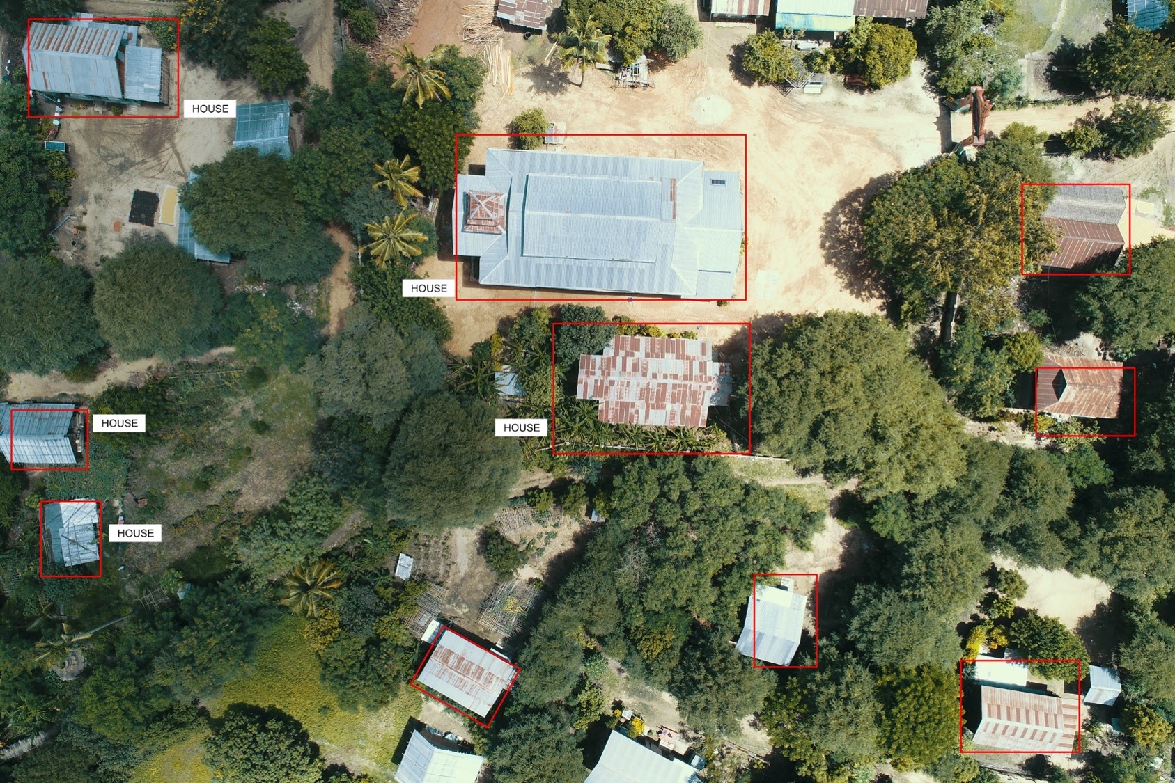
The image data is a key factor in the use of deep learning, which is why careful annotation or selection of the database is of crucial importance. For example, the marking and labelling of »interesting« data in the original images and the selection of the »right« data for training are required. The result of this process is an image database that serves as the basis for training and evaluating the procedures. As part of the project, a wide variety of data sets – for example from the Dominican Republic – were therefore annotated directly on site by the experts and organised in a database by the project team.

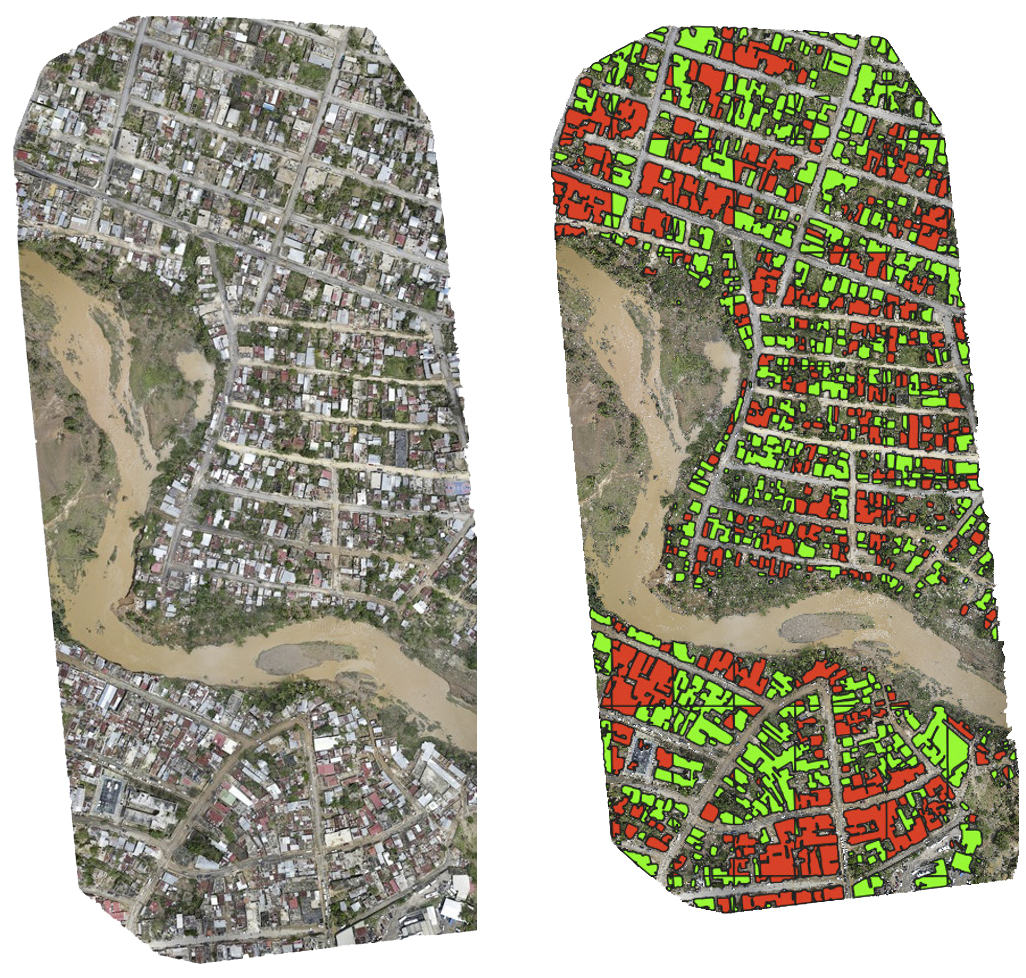
EDDA: Hurricane Fiona hit the Dominican Republic
© Fraunhofer ITWM
Hurricane Fiona hit the Dominican Republic on 19 September 2022. The WFP used the EDDA software to support the Dominican government in collecting information to assess the damage. On the left a section of the drone images, on the right the evaluation. Red buildings are damaged, green buildings are undamaged.

Outlook: What Happens Next?

The team is currently focussing on detecting floods and flood damage. The roadmap envisages recognising other infrastructure – such as roads and bridges – and assessing their condition. Ultimately, the aim is not only to assess the situation after or during a disaster, but also to provide the emergency teams on site with planning aids. This involves, for example, the question of how a rescue team can get to certain locations as quickly as possible without exposing the team to high risks.

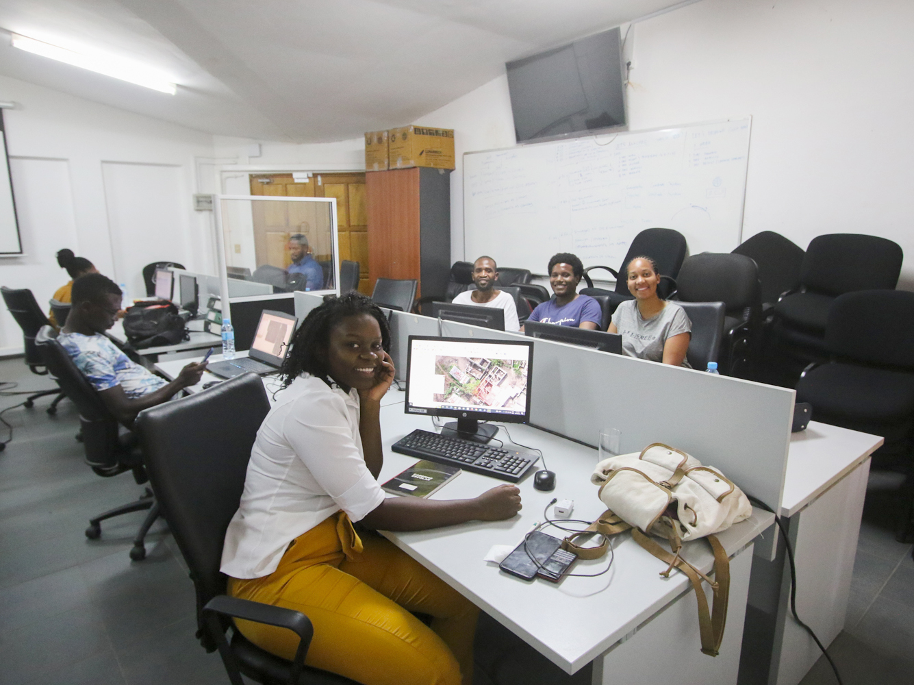
Students sit at computers during group work in the workshop room.
© Fraunhofer ITWM
One of the biggest challenges in the EDDA project is obtaining a data set so that the EDDA software can evaluate the situation in the disaster area. Pictured here: As part of the project, there was a workshop in Maputo, Mozambique, where Cyclone Idai (tropical storm) caused a lot of destruction in 2019. Here you can see the participants processing the data.
Annotierte Luftaufnahme aus einem Erdbebengebiet in Mozambique.
© WFP / Fraunhofer ITWM
Annotierte Luftaufnahme aus einem Erdbebengebiet in Mozambique.
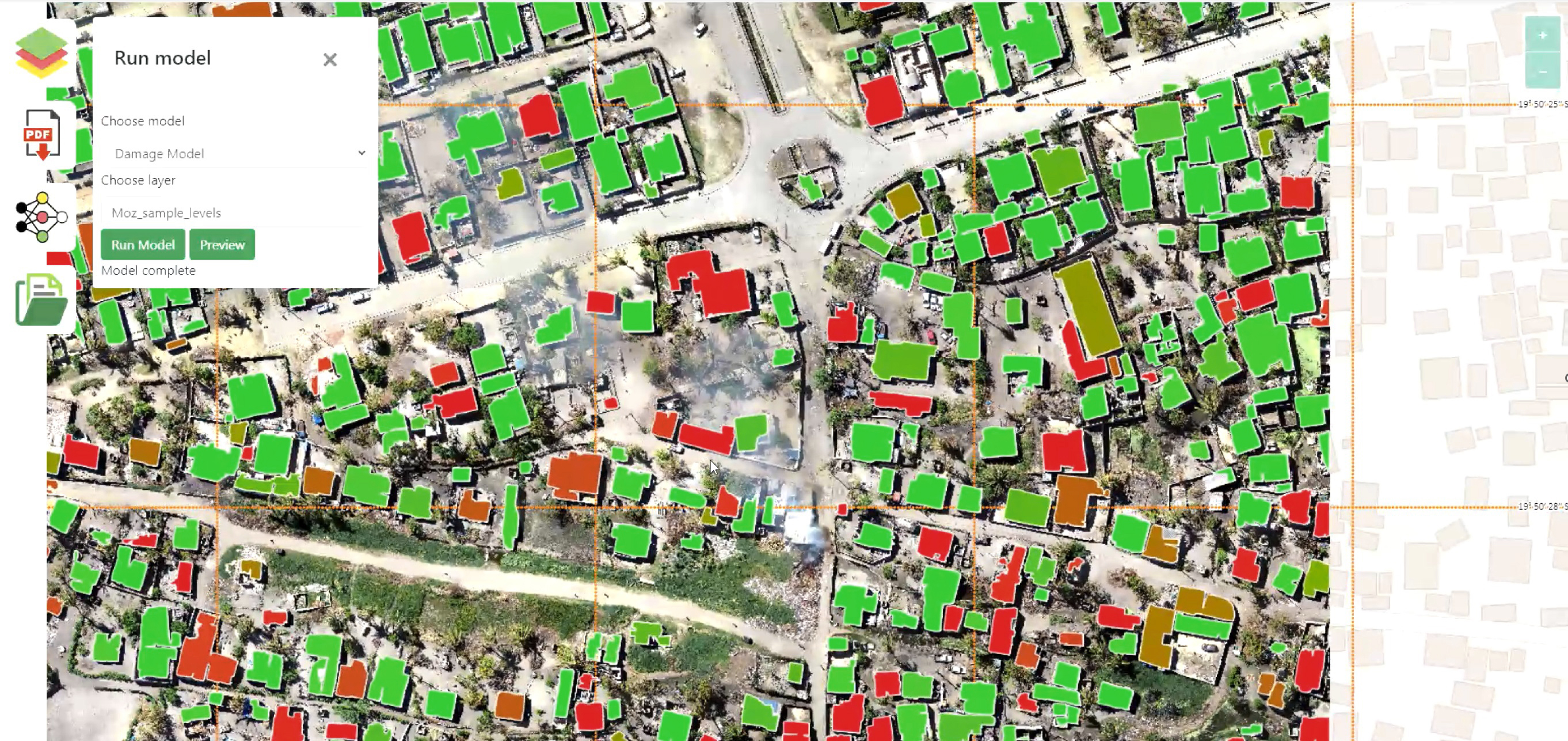
Screenshot of the image recognition software EDDA.
© Fraunhofer ITWM
Screenshot of the image recognition software EDDA.